
Some pasture measurements are satellite-backed, meaning they are informed by a recent usable satellite image. Other values may come from Pio’s Cloudy Days model, which helps estimate pasture cover and growth when a usable satellite image is not available.
This article explains how often pasture measurements may update, the difference between satellite-backed and Cloudy Days measurements, and why measurement frequency can vary from farm to farm.
What is a satellite-backed pasture reading?
A satellite-backed pasture reading is a pasture cover or growth estimate that uses a recent usable satellite image of your farm.
For a satellite image to be used, it needs to be clear enough for Pio to interpret the pasture area. This means the image needs to capture the farm clearly and be suitable for pasture analysis.
A satellite may fly over your farm, but that does not always mean a usable image is available.
Usable imagery can be affected by:
- cloud cover
- haze or smoke
- shadow
- image quality
- partial farm coverage
- local conditions
- whether the image clearly captures your farm area
This is why satellite flyovers and satellite-backed pasture readings are not the same thing.
What is a Cloudy Days modelled pasture reading?
When a usable satellite image is not available, Pio may use modelling to help estimate pasture cover and growth between satellite-backed readings.
Modelled values help provide continuity, especially during cloudy periods or when image quality is limited.
Pio’s modelling may use information such as:
- previous pasture readings
- local weather data
- grazing records
- farm setup
- growth conditions
These modelled values are designed to help you keep tracking pasture trends between usable satellite images.
Satellite flyovers by plan
The frequency of satellite flyovers depends on your Pasture.io plan and your location.
Ultimate add-on
The Ultimate add-on has near-daily satellite flyovers in many locations.
Essential add-on
The Essential add-on has satellite flyovers approximately every 5 days in many locations.
However, a satellite flyover does not guarantee a usable satellite image or a satellite-backed pasture reading on that day.
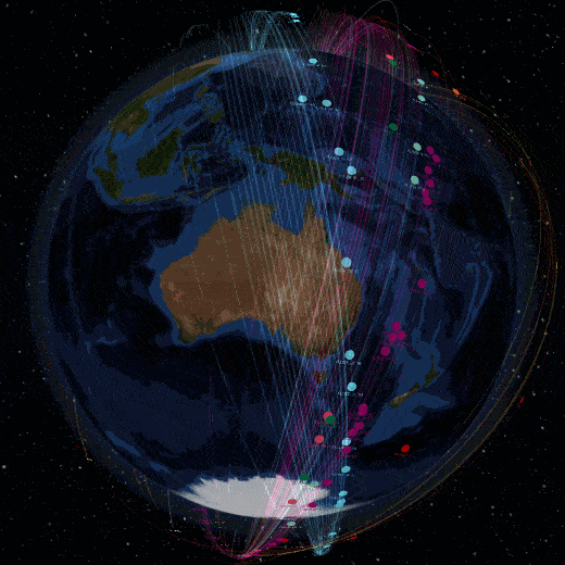
Our Ultimate plans tap into over 150 satellites that are orbiting the earth each and every day, just check out the image below:
Which plan is best for high-rainfall areas?
If your farm is in a high-rainfall or cloud-prone area, we generally recommend the Ultimate add-on.
This is because the Ultimate add-on has near-daily satellite flyovers in many locations, which gives Pio more opportunities to capture usable imagery between cloudy periods.
In high-rainfall areas, cloud cover can reduce the number of usable satellite images. Having more frequent flyovers improves the chance of getting enough usable imagery to support regular pasture readings.
However, it is important to understand that even with the Ultimate add-on, usable imagery is not guaranteed every day. Satellite image availability still depends on cloud cover, haze, smoke, shadow, image quality, and local conditions.
The Essential add-on may still be suitable in some lower-rainfall or less cloud-prone regions, but in areas where frequent pasture readings are important and cloud cover is common, the Ultimate add-on is usually the better fit.
What should I expect?
Your satellite-backed reading frequency will vary depending on your plan, location, season, weather, and image quality.
Some farms may receive usable imagery more often than others. Even on the same plan, image availability can vary between regions and across the year.
The best way to use Pasture.io is to look at pasture trends over time, rather than relying on one reading from one day.
Where can I check my satellite backed readings?
You can view your historical satellite backed readings in Pasture.io from the Readings page.
Here, you can check:
- the date of the latest satellite backed reading
- which paddocks were included
- pasture cover values
- growth rates
- whether the reading matches what you are seeing on farm
If a reading does not look right, it is worth checking recent grazing records, paddock boundaries, and whether cloud or image quality may have affected the image.
Take-home message
Not every pasture value in Pasture.io is based on a new satellite image.
Some values are satellite-backed, using recent usable satellite imagery. Other values may be modelled to help provide continuity between satellite-backed readings.
The Ultimate add-on gives more frequent satellite flyover opportunities and is generally recommended for high-rainfall or cloud-prone areas where regular pasture readings are important.
However, usable imagery is never guaranteed. Cloud cover, image quality, location, and local conditions can all affect whether a satellite image can be used.