
-
Create your activity ie fertiliser, spray, harvest, planting or grazings
-
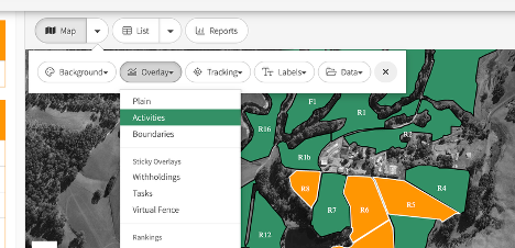
Make sure the Activities overlay is selected
-
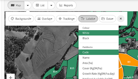
Turn on the useful layers ie Paddock code or name
Map:Labels
-
Generate the Map - Zoom in or out the map to show the relevant information
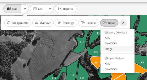
Map:Data:Image
-
Download PNG or JPG and save to your computer
-
Print, Email, SMS as required
Tip: What you see on your map is the data image you generate.
This could also be applicable to cover overlay and labels information